Khertvisi. A fortress above two rivers
The history of a fortress in Samtskhe–Javakheti, with watercolour views of its citadel and an interactive 3D model.
Open the interactive 3D model of Khertvisi →
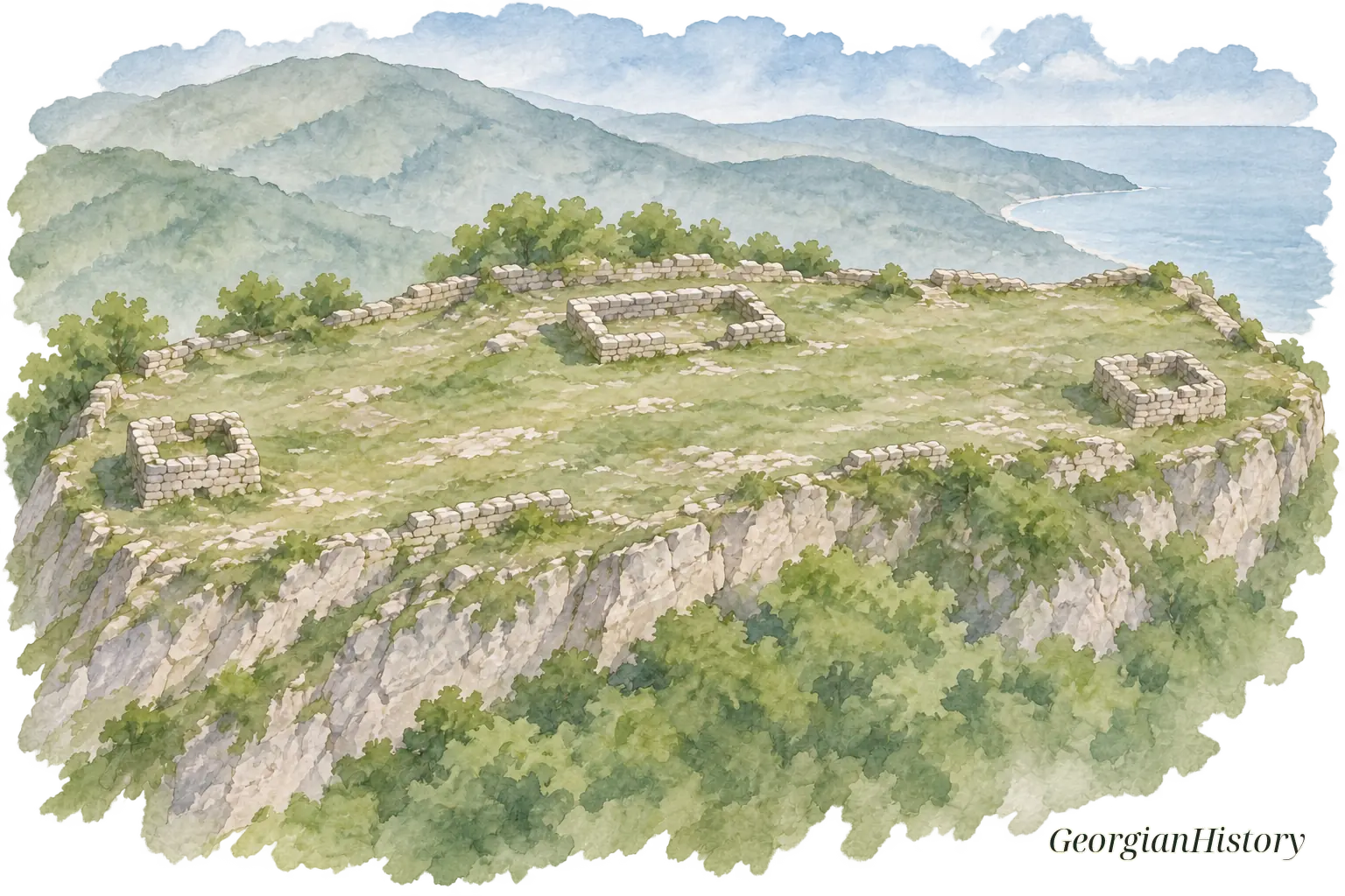
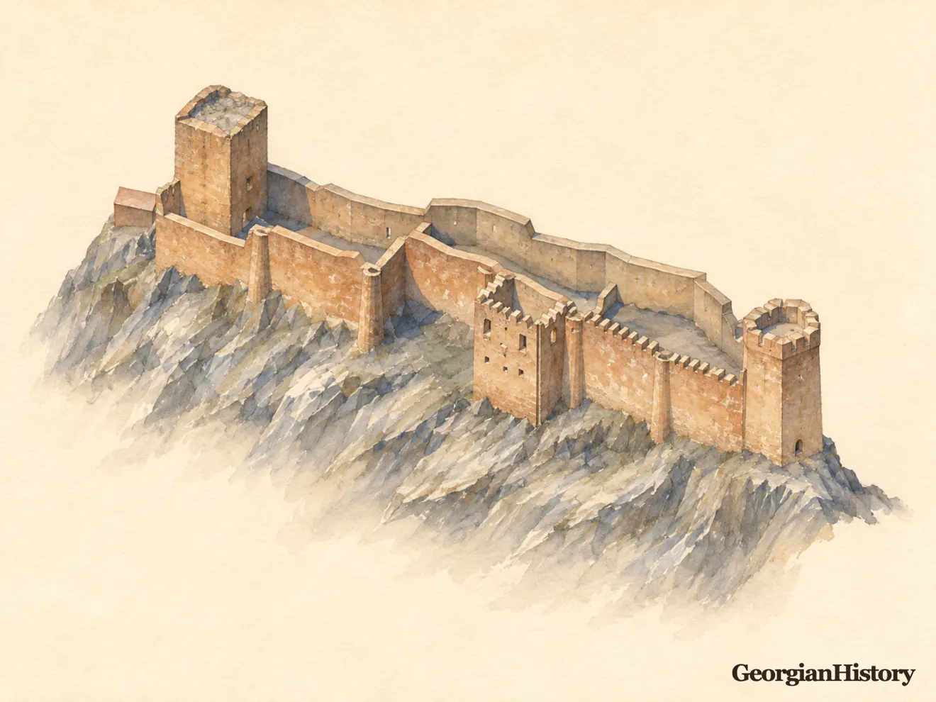
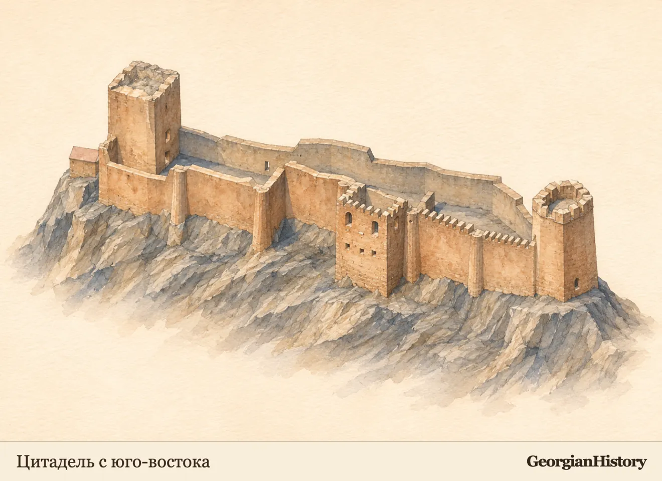
On a rocky ridge in Samtskhe–Javakheti, the walls of Khertvisi rise and fall with the rock. Two very different towers stand at either end of the upper citadel: a western keep with rounded corners and a five-sided eastern tower. Below them lies the lower courtyard, whose walls descend towards the eastern gate. The layout is easiest to make out from across the rivers or from above. These are the views GeorgianHistory used to build its digital reconstruction.
Where the Mtkvari and Paravani meet
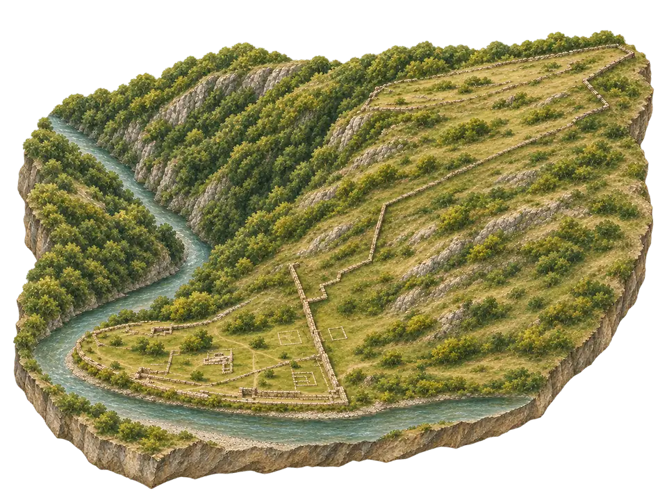
The fortress stands beside the village of Khertvisi in Aspindza Municipality, where the Paravani flows into the Mtkvari. The rock overlooks the valleys and the routes that converge at the crossings. The ridge itself accounts for the long, narrow plan. The citadel occupies a slender platform at the top, where the walls bend around projections and breaks in the rock. The lower enclosure takes in a wider stretch of the slope. Khertvisi is part of the Vardzia–Khertvisi complex, which Georgia submitted to the UNESCO World Heritage Tentative List in 2007.
Two lost inscriptions
A surviving account of an inscription associated with the church at Khertvisi gives the year 985 and mentions a “king of kings”. The inscription itself is lost. The account links that date to the history of the church, but the precise nature of the event and the extent of the masonry from that time remain open questions. Tamta Dolidze also dates the earliest identifiable phase of the fortress to the tenth century.
A second inscription once stood above the entrance to the fortress. According to the recorded text, Zakaria Kamkamishvili began work on a wall and a tower in 1354 and finished in 1356. The traveller Dubois de Montpéreux recorded the inscription in the nineteenth century, and Ekvtime Takaishvili published the text in 1909. The record does not establish which surviving tower the inscription referred to.
In 1578, during the Ottoman advance, Arpaksad, son of Iotam, handed Khertvisi and other fortresses over to Lala Pasha. Khertvisi became the centre of an Ottoman administrative district. Erekle II briefly took the fortress in 1771. It passed under Russian control during the war of 1828–1829, and the Treaty of Adrianople confirmed the change in the border. The buildings at Khertvisi bear the marks of several phases of this history.
Towers on the ridge
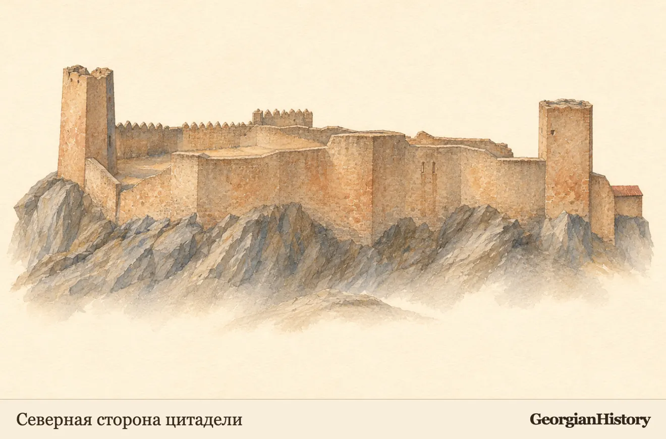
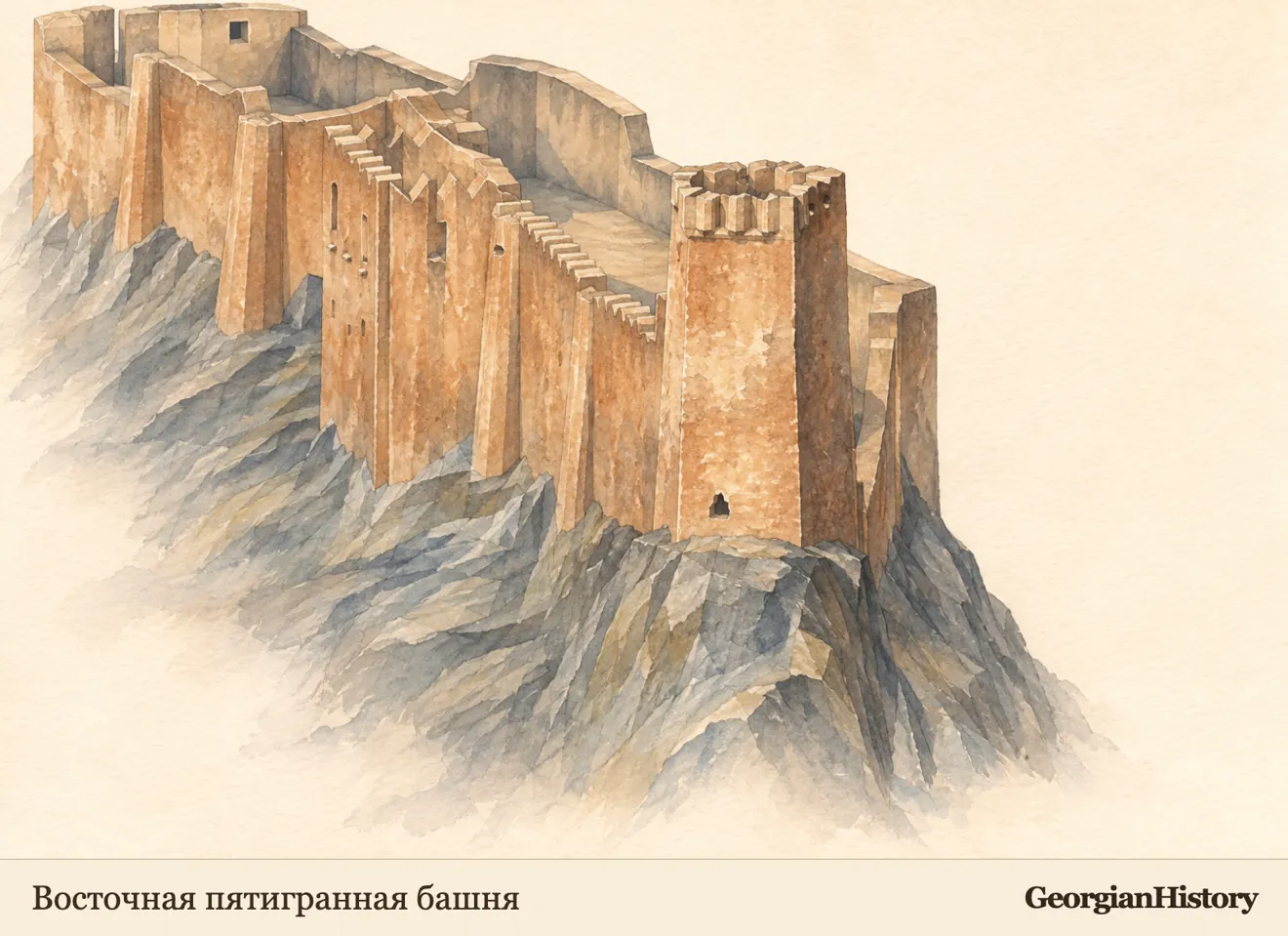
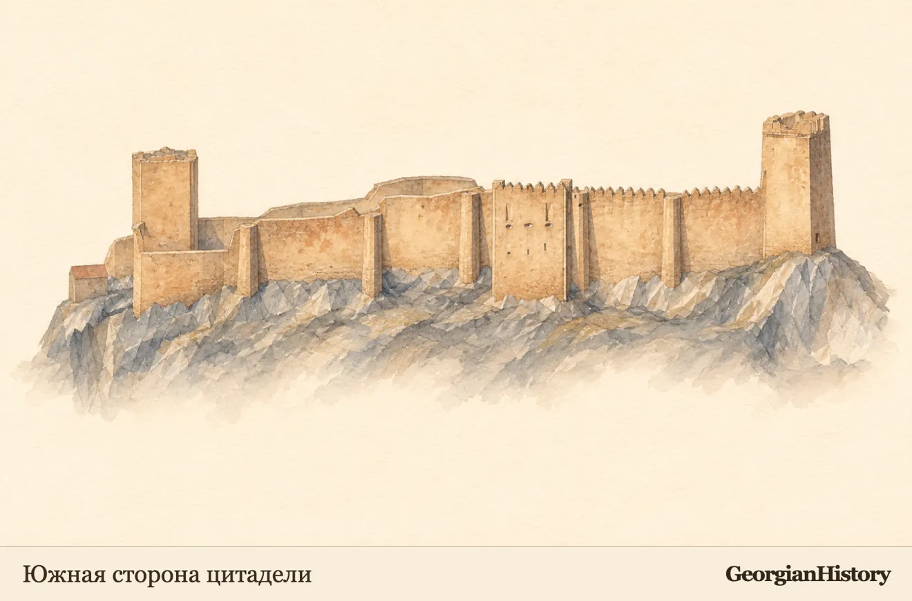
The western keep is roughly square in plan. Its corners are rounded and its faces are almost vertical. The eastern tower stands at the end of the ridge. Its masonry rests on a rocky projection at the base, and the wall joins its southern face. Between the towers, the south front is broken up by offsets, buttresses and a four-sided projection with openings. On the north, the wall bends with the ridge. The plan and axonometric drawing published by ICOMOS provided reference points for aligning the scan and ground photographs with the digital model.
In Dmitry Rodionov’s 2014 photograph, the eastern tower is seen from the courtyard through an arch in a cross-wall. The photograph shows how the passage connects two parts of the citadel. A 2018 photograph by Gaga.vaa, taken from the southeast, shows the base of the tower, the uneven top of the masonry and the point where the wall meets it. These views help check the openings and junctions. Exact heights and the profile of the rock beneath the tower would require a ground survey.
A chamber with a stone dome survives in the western keep. Looking up, you can see how corner arches called squinches turn the square chamber into a circular base for the dome. A separate cutaway shows this transition. The dome’s curvature, thickness and elevation in the model are approximate.
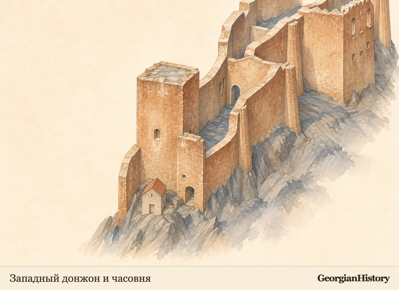
St George’s Chapel
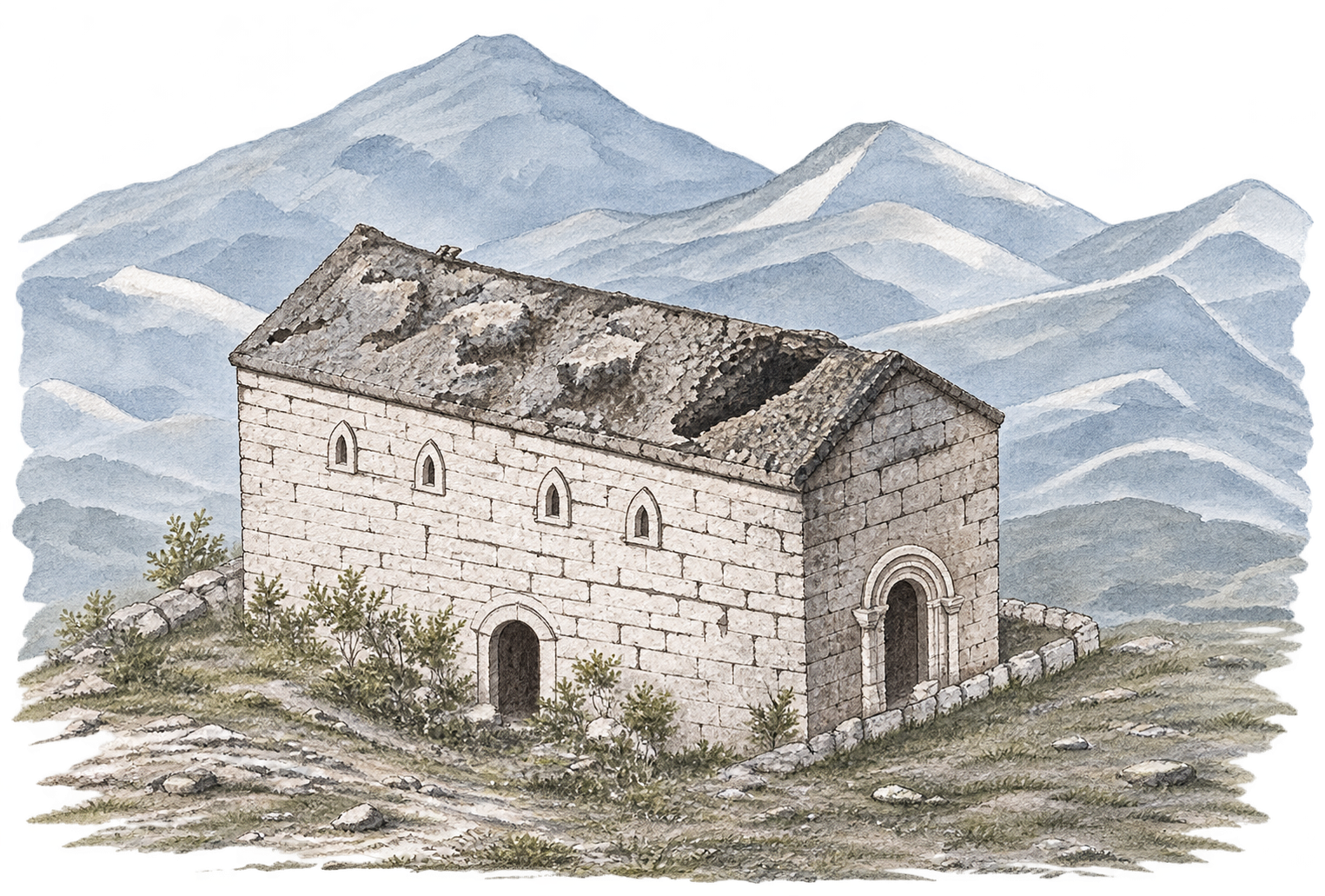
A small, single-nave chapel stands on a rocky platform beside the keep. The municipal description gives external dimensions of 2.7 × 4.3 m. The only entrance faces west, and the west and east walls each have a narrow arched window. The sanctuary floor is cut into the rock and sits one step above the nave.
An interior photograph shows the transition from the nave vault through a projecting arch to the half-dome over the apse, known as a conch. A panorama published in 2019 lets you turn towards the western entrance and see the shallow curve of the vault above the window. The model shows both junctions. A measured section is needed to determine the rise and curvature of the vault along the full length of the nave.
The lower courtyard and eastern gate
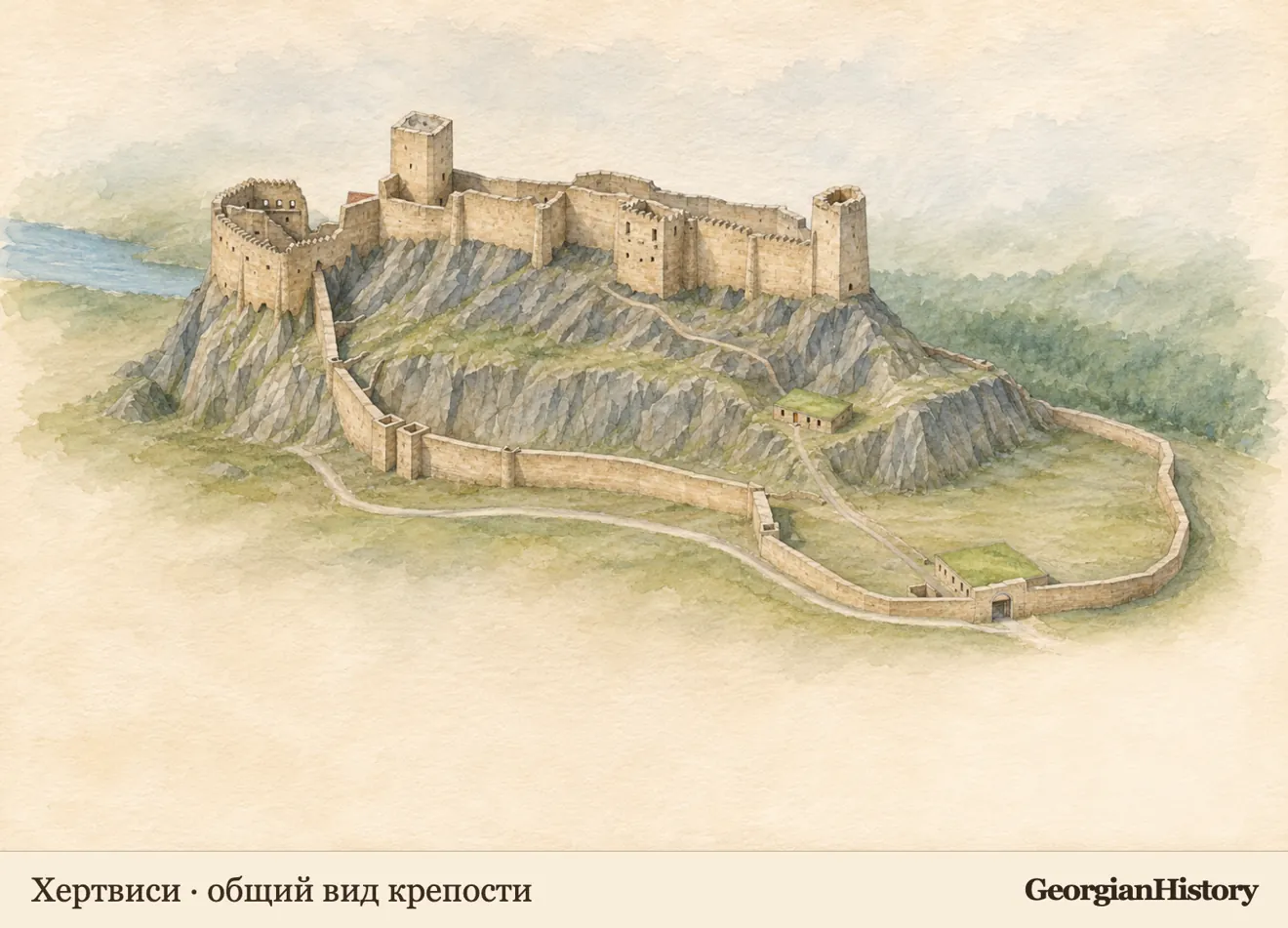
The walls descend from the citadel, following the terraces and enclosing the lower courtyard. On the south side, two four-sided projections flank a passage. Farther east, the enclosure changes direction and runs to the main gate. A stretch of masonry on the northern slope can be traced as far as a rocky projection. Exactly where it joined the citadel is still unclear, so the model leaves a gap there.
The 2017 improvement project for Khertvisi included restoring the gate. A photo report published on 26 March 2018 shows the stepped top of the masonry, a shallow stone arch, the recessed area beneath it and the horizontal lintel above the metal grille. The model follows the gate front as it appears in that report. Establishing the depth of the passage and the earlier form of the gate requires the archival surveys mentioned in the project documents.
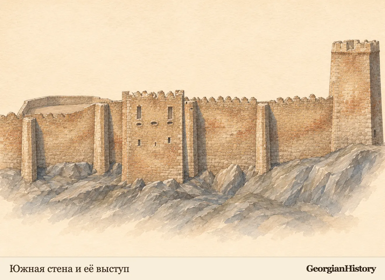
What the 3D model can show
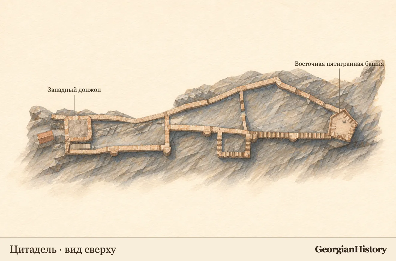
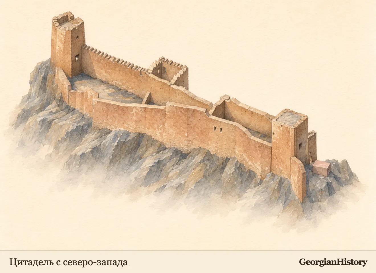
From above you can follow the outline of the defences from the keep to the eastern tower. The north and south views show where the rock slopes away under the walls. The cutaways show the chapel apse, the vault above its western entrance and the dome of the keep. The lower fortress is clearest from the gate or in the wider view of the valley.
The model scale is approximate. On the grid of project sheet 40, the distances between the eastern gate, the administration building and the rectangular projection at the bend in the wall suggest 0.96–0.99 m per model unit in the plan of the lower fortress. The reference points on the drawing and the model were chosen approximately. Survey measurements are still needed to calibrate the upper citadel, the heights and the thickness of the masonry. The form of lost floors, tower tops and concealed parts of the underground structures remains uncertain.
Sources and further reading
- UNESCO World Heritage Tentative List
- Cultural Heritage Register: keep no. 8215
- Photographs no. 10426
- Photographs no. 10427
- Aspindza Municipality
- Tamta Dolidze, “Khertvisi Fortress”
- Gema Rod panorama, around 3:18
- Municipal Development Fund: aerial photographs and plans, 2017
- South Gate photo report
- Municipal Development Fund project: baseline conditions
- Ministry announcement, May 2018
- Municipal Development Fund project, sheet 40
- ICOMOS Georgia: plan and axonometric drawing, 2014
- Nik: photogrammetric scan of Khertvisi
- CC BY 4.0
- Gaga.vaa: view from the north, 2018
- South wall
- Gaga.vaa: view from the southeast, 2018
- Dmitry Rodionov: view from the courtyard, 2014
- CC BY-SA 3.0
- Sogomon Matevosyan: interior, 2015
- CC BY-SA 4.0
- Mapzen Terrain Tiles
- Elevation dataset attribution
- Esri World Imagery