Shirvan in Queen Tamar’s Time
Who ruled the western shore of the Caspian Sea, why the Shirvanshah turned to Tamar, and what changed after the Battle of Shamkor.
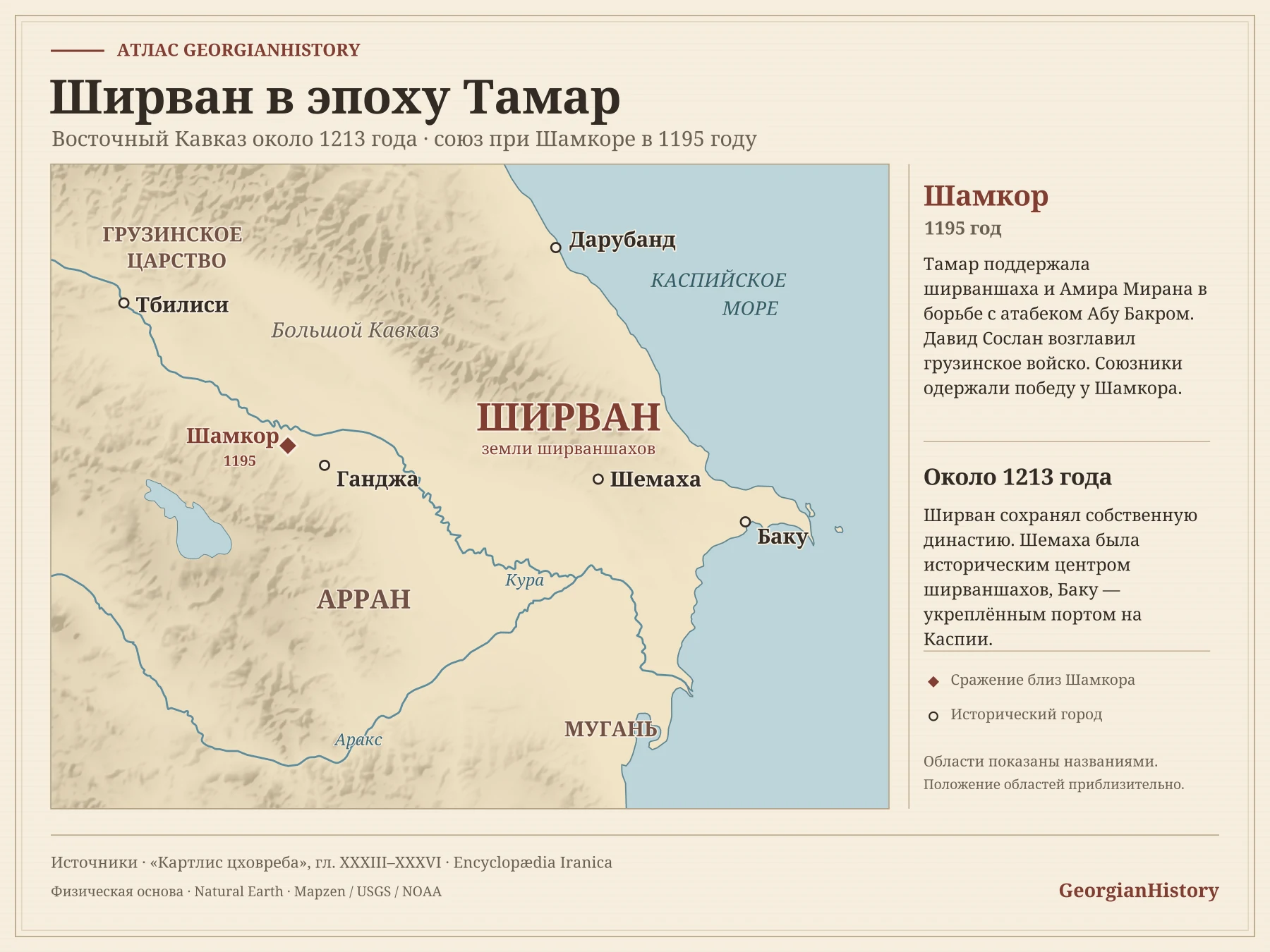
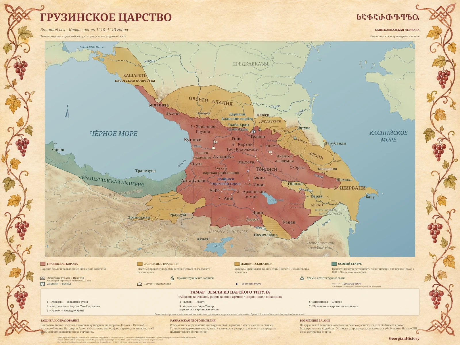
 Shirvan occupied lands in the eastern Caucasus between the foothills of the Greater Caucasus, the lower Kura and the Caspian Sea. Today the region is part of Azerbaijan. Shamakhi was the historic centre of the Shirvanshahs, while Baku was a fortified port on the Caspian. Shirvan had a dynasty of its own. Marriages with the Georgian Bagrationi linked the two courts, and the Georgian crown held considerable influence in Shirvan in the mid-twelfth century.
Shamkor, 1195
After the death of Qizil Arslan, a struggle for power broke out within the Ildegizid dynasty. Amir Miran challenged his brother, the atabeg Abu Bakr. The Shirvanshah backed Amir Miran, and both appealed to Tamar for help. David Soslan commanded the Georgian army. The allies’ victory at Shamkor forced Abu Bakr to retreat towards Nakhchivan.
The Georgian chronicle records that, after the victory, David handed Shamkor and its surrounding fortresses to Amir Miran. It also describes the acknowledgement of the Georgian court’s supremacy. According to historian Kenneth Luther’s reconstruction, Ganja returned to Abu Bakr’s control after Amir Miran’s death. The military alliance shifted the balance of power, while the Shirvanshahs retained authority in their own lands.
How to read the map
The map shows the eastern Caucasus around 1213. Daruband, now Derbent, lies by the northern Caspian passage. Shamkor and Ganja lie west of Shirvan, in historical Arran. The marker by the medieval site of Shamkor refers to the battle of 1195. Regional names indicate approximate locations because boundaries changed.
 All journal maps →