The Kingdom of Georgia and the Caucasus around 1210–1213
A political map of Tamar’s era showing lands of the Georgian crown, neighbouring powers, and territories linked to the kingdom. Zoom in or download the 10K map.
What the map shows
 The map shows the Kingdom of Georgia and its neighbours in the early thirteenth century. The kingdom’s outline includes lands governed by nobles subject to the crown. The legend distinguishes domains with their own rulers, tributary relationships and the particular case of Trebizond.
How to read the boundaries
This is a reconstruction of political geography around 1210–1213. The outlines of historical regions are approximate. Forms of dependence and the extent of domains changed, especially on the frontiers. The atlas has separate maps for linguistic and cultural areas.
Trebizond and Shirvan
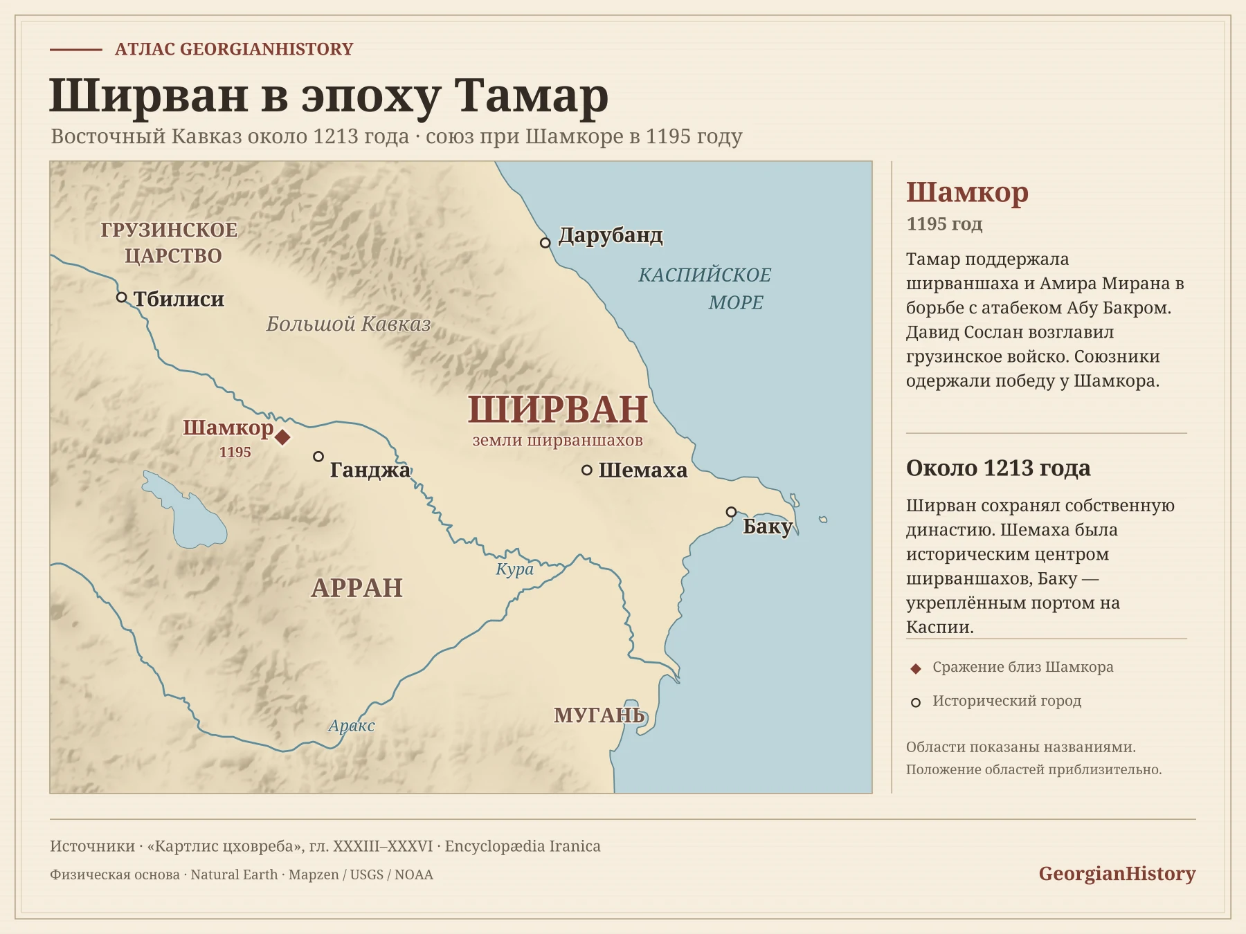
Tamar supported the establishment of the Komnenian state at Trebizond in 1204. The extent of its dependence on Georgia remains open to debate. Shirvan retained its own ruling dynasty. A separate article discusses its relations with Georgia and the events at Shamkor.
Sources and further reading
- The Histories and Eulogies of the Sovereigns. Georgian chronicle of Tamar’s reign
- Kirakos Gandzaketsi. History of Armenia
- Georgian Encyclopedia. Alexios I Komnenos and the founding of the Empire of Trebizond
- Cartographic basis for the boundaries. Don-kun, Bourrichon, GeorgeM. Adapted by GeorgianHistory, CC BY-SA 3.0
- Natural Earth. Base geography and hydrography
- Mapzen Terrain Tiles. Sources of elevation data
 All journal maps →