Georgian Banners on Old Nautical Charts
What 14th- to 16th-century portolan charts can tell us about the Georgian lands, and where the evidence ends.
 On an old nautical chart, a flag can take up only a few millimetres. That tiny detail shows how the mapmaker understood the coast, its cities and their political ties. Among such images are crosses above Tbilisi, stripes by Sebastopolis, a hand on a red field and symbols near Phasis. All bear on the history of the Georgian lands. They need to be read as drawings on charts. The actual battle banners have not survived.
A portolan chart is a nautical map showing shores, harbours and sailing directions. Mapmakers also put flags and heraldic devices on these charts. They could record information about who governed a city, copy another maker’s design or retain a symbol after the political situation had changed. The location and date of an image can therefore be established more securely than the precise meaning of each colour and figure.
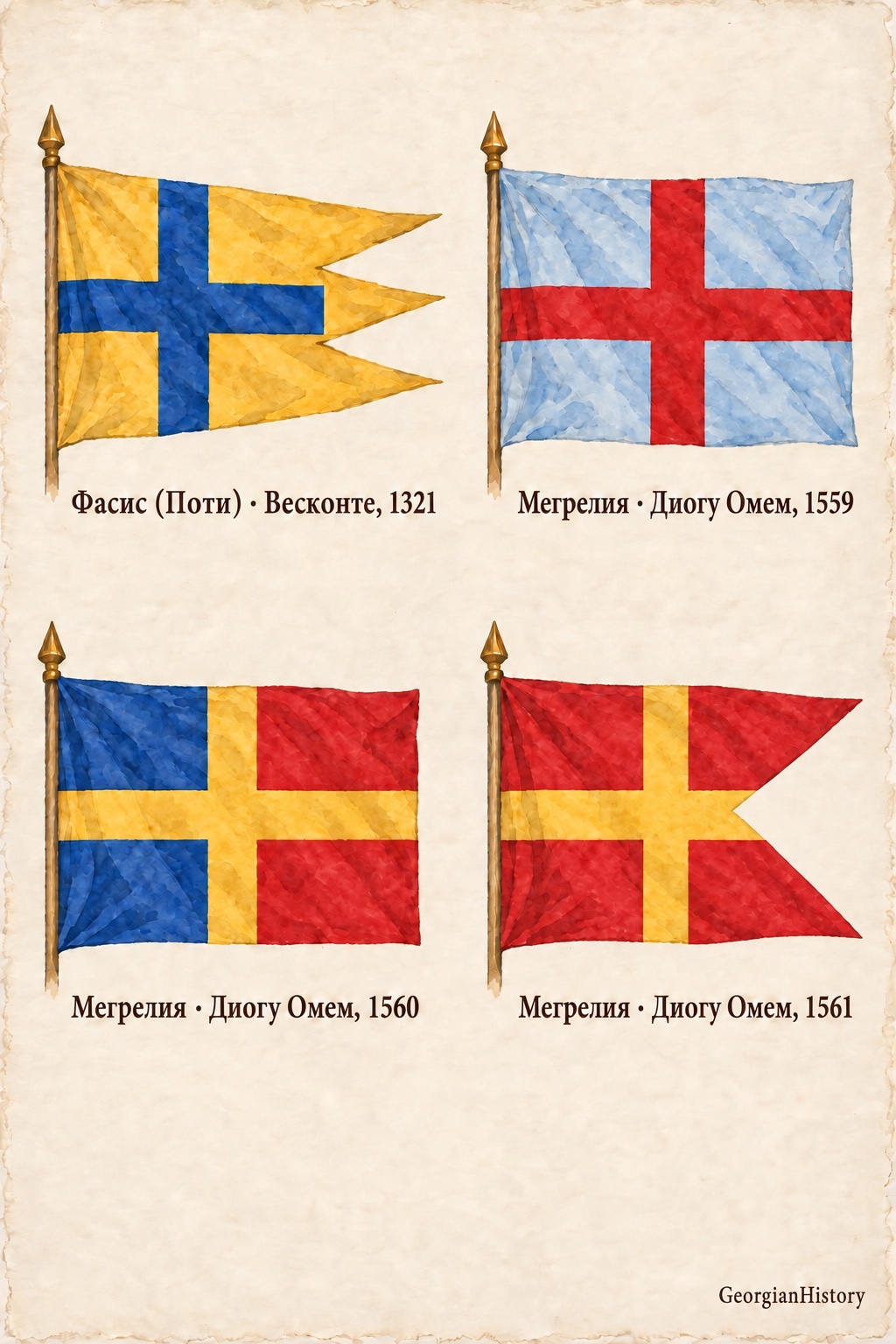
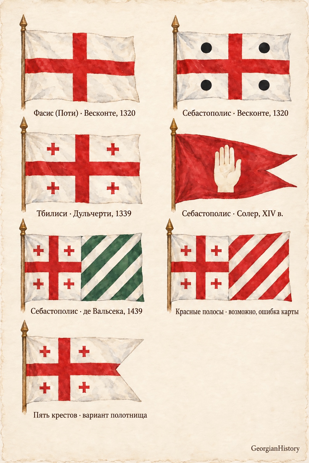
Pietro Vesconte left some early examples. On his 1320 map of the Black Sea, a banner with one cross appears near Phasis, in the area of present-day Poti. Near Sebastopolis, now Sukhumi, there is a large cross and four roundels. The Georgian Encyclopedia describes the roundels as black. Modern redrawings sometimes colour them red. For an accurate caption, the colour recorded in the source description matters more. A different design appears near Phasis on the 1321 chart, a yellow three-tailed banner with a blue cross. Further evidence would be needed to explain the difference as a change of state flag.
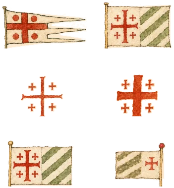
By the mid-fourteenth century, a design of five red crosses on a white field appears on maps. On Angelino Dulcert’s portolan of 1339 it flies above Tbilisi. By Sebastopolis, the cartographer combined five crosses with a striped section. The historian Mamuka Tsurtsumia identifies the stripes as green and suggests that the combination might indicate a connection between Georgian royal authority and the local domain of the Dadiani. This is a historical interpretation. The cartographer left no such caption. The five-cross device over Tbilisi recurs on the Pizzigani brothers’ map of 1367.
Sebastopolis was also marked with other symbols. On a map made by Guillem Soler between 1368 and 1385, the city is marked with a white hand on a red field. Similar devices occur in other medieval images. They have been interpreted in different ways. It would be premature to identify the hand categorically as the banner of a particular kingdom or people.
From 1439 onwards, maps by Gabriel de Vallseca again show a composite device over Sebastopolis, five red crosses and green diagonal stripes. There is also a known map with red stripes. Tsurtsumia allows for an error in colouring but argues that the chart itself needs to be examined before drawing a firm conclusion. The cut-out on the free edge of the banner in one of our watercolour diagrams shows a variant of the design’s shape. It does not establish a separate historical banner.
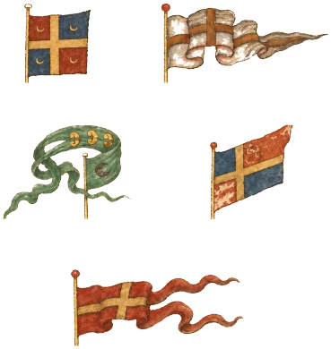
The images change more visibly in the sixteenth century. On charts of the Portuguese school, designs with blue or red fields and red or gold crosses appear near Mingrelia. Diogo Homem’s chart of 1560 shows blue and red sections divided by a gold cross. In other depictions a red banner with a gold cross has two tails. Our watercolours present these devices as modern illustrations of portolan charts. They do not establish a single unchanging flag for Mingrelia throughout the century.
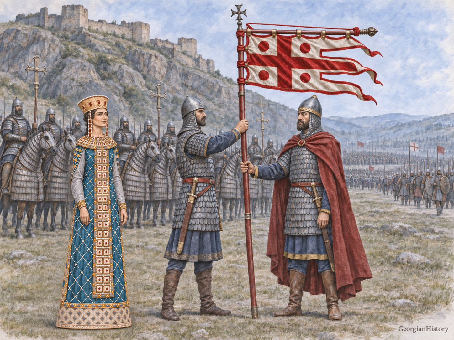
Today a white banner with five red crosses is Georgia’s national flag. It was adopted on 14 January 2004. The similar five-cross device on fourteenth-century charts provides important historical context for the modern symbol. Centuries of change separate the medieval drawing on the portolan from the modern national flag. The strength of this history lies in what we can verify. We can name the map, year and city and distinguish the cartographer’s drawing from the questions that historians still need to answer.
Note on the illustrations
These watercolours are modern artistic reconstructions of devices on portolan charts. No photographs of medieval banners are involved. Researchers render the colour of the stripes near Sebastopolis on Dulcert’s map differently. The blue banner with a red cross labelled “Mingrelia, 1559” needs to be checked further against the original chart. The red diagonal stripes and the cut-out banner are shown as variants of the image. There is no established evidence that they were separate state flags.